
MIDNIGHT
A system to survey, detect, and localize nuclear threats
in challenging and dynamic public spaces
A system to survey, detect, and localize nuclear threats in challenging and dynamic public spaces
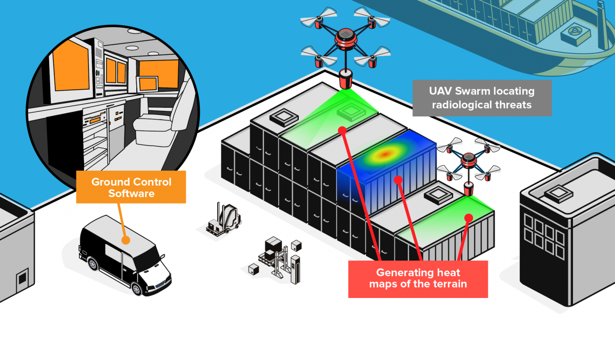
Monitoring and Inspecting Dirty Nukes Including Generating Heat Maps of Terrain (MIDNIGHT)
MIDNIGHT enables multiple coordinated uncrewed aircraft to survey, detect, and localize nuclear threats in challenging and dynamic public spaces.
Charles River has successfully developed numerous mature field-tested autonomous navigation technologies across multiple domains that keep human operators out of harm’s way.
Contact us to learn more about MIDNIGHT and our other robotics and autonomy capabilities.
This work is supported by the U.S. Department of Homeland Security, Countering Weapons of Mass Destruction, under competitively awarded contract 70RWMD20C00000003. This support does not constitute an express or implied endorsement on the part of the Government.